Satellite Imagery
The best 50 Satellite Imagery AI tools - Free & Paid
Explore 50 AI for Satellite Imagery
FlyPix AI automatically detects buildings, roads, vegetation, and infrastructure in satellite, aerial, and drone imagery, reducing annotation effort by up to 99.7%. It supports custom model training, multispectral data, and collaborative dashboards for construction, agriculture, and risk management.
Subscription

Picterra delivers GeoAI analytics converting satellite and aerial imagery into near-real-time land monitoring and geospatial insights, detecting land-use change, deforestation, erosion, and compliance risks, linking outputs with ESG and supply-chain data for prioritized interventions and reporting.
Freemium
worldmonitor.app is a real-time global intelligence dashboard that overlays live signals from 500+ feeds and 65+ data providers onto an interactive map. It correlates geopolitical events, infrastructure outages, and sensor alerts with market movements for analysts, traders, and risk managers.
Freemium

Cybertiks uses satellite imagery and AI to provide accurate soil nutrient, texture, and mineral data for agricultural fields. Users enter coordinates to view up‑to‑date weekly metrics on dashboards, integrating optical and radar sensor fusion.
Freemium
OpalAi’s Vision Language Models cut video analysis from hours to minutes for planners and safety teams. Its wildfire intelligence turns geospatial data into actionable risk insights, while ScanToBIM/ScanTo3D convert point clouds into BIM or CAD models instantly.
Subscription
DeepAI offers browser‑based AI tools for text‑to‑image, photo editing, background removal, super‑resolution, and video/musical generation, plus APIs for integration. It prioritizes user ownership, privacy, fast processing, and supports conservation research via object detection and habitat mapping.
Subscription

iris roads automates road inspections with AI cameras, automatically redacts privacy, identifies defects such as potholes and cracks, delivers condition indices and repair priorities to public‑works dashboards, and integrates with CityWorks and Cartegraph for streamlined workflow and cost savings.
Freemium

SeeTree digitizes large farms with AI, scanning millions of trees via drones, aircraft, and satellites to provide per‑tree metrics, pest‑management, yield forecasting, GIS mapping, and asset tracking, boosting yield, cutting inputs, and improving operations.
Freemium

Rapid Editor is a web-based OpenStreetMap editor that integrates authoritative open geospatial data and machine-learning detections to import geometry, display AI-predicted roads/buildings/land use, validate edits, coordinate mapping tasks, and support bulk imports.
Globe Explorer is an AI-driven platform for data analysis and trend identification, offering robust topic discovery, visual data representations, insightful reports, and collaborative features to enhance research for educators, researchers, and content creators.
Freemium
MapZot.AI provides location intelligence for site selection, revenue forecasting, and impact analysis. It integrates live traffic, GIS, and mobile data to model foot traffic and competition, generating 360° property reports with projections, benchmarks, and business activity.
Freemium

ClimateLens offers 1 km resolution climate insights for the food, agriculture, and related sectors. It aggregates weather data, selects optimal forecasts via machine learning, provides real‑time alerts, custom dashboards, and an API for seamless enterprise integration.
Freemium
Open Knowledge Maps is an AI search engine that visualizes scientific literature across disciplines, clustering related papers to reveal topic connections and trends. It supports varied document types, offers high‑quality metadata, multilingual browsing, and open‑source integration.
Freemium
Topical Map AI automates social media and SEO keyword research, generating over 1,000 targeted keywords in seconds. It offers map creation, metrics viewing, and filtering capabilities across 20+ languages, streamlining content strategy for bloggers and marketers.
Freemium
Spatial.ai is an AI tool that uses web and mobile activities to provide real-time behavior segmentation for various industries through their Personalive™ system.
Contact
XLeads AI streamlines real‑estate wholesaling by combining satellite‑based distress scores with AI‑powered lead filtering. It bundles a CRM, dialer, e‑signing, SMS, and skiptracing into a single dashboard, delivering daily data refreshes, probate lists, and automated outreach.
Subscription
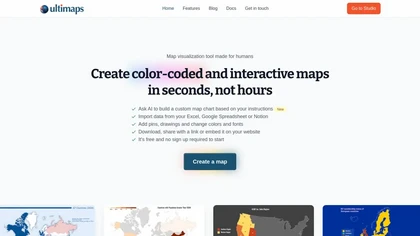
Ultimaps is a user-friendly tool for creating interactive, color-coded maps quickly. It supports data import from various sources and offers features like pins, editable legends, and tooltips, with no sign-up required for basic use.
Freemium
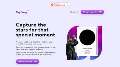
SkyFrom generates high‑resolution printable star‑maps for any date, time, and location using ESA Hipparcos data. Users choose a template, input details, add text, and download a 3956×5276 JPEG ready for print.
Paid
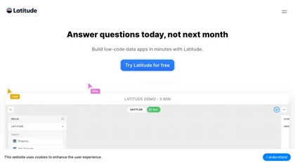
Latitude offers end‑to‑end observability for LLM deployments, recording inputs, outputs, and context. It enables manual annotations, automated error grouping, continuous evaluation, and prompt optimization with GEPA. OTEL telemetry and SDK integrations support major model providers.
Freemium
- $299/mo
BrandRadar delivers AI-driven GEO insights and visibility scoring with citation mapping, keyword gap analysis, prompt testing and competitive benchmarking, plus cross-platform content generation and APIs to prioritize regional SEO, local search opportunities and multi-region monitoring.
- $49
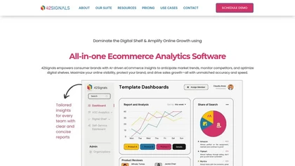
42Signals AI delivers real‑time e‑commerce intelligence, tracking product listings, pricing, and search performance across major marketplaces. It monitors unauthorized sellers, provides price alerts, and analyzes customer reviews to inform inventory and marketing decisions.
Subscription
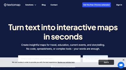
Textomap turns text, images, links, and CSVs into interactive maps instantly. It extracts coordinates, supports 28 languages, and lets users embed maps on blogs, export CSVs, or link to Google Maps, with real‑time updates across devices.
Freemium
- $8/mo
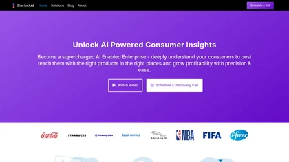
SherlockAI delivers real‑time consumer movement and behavior insights by aggregating millions of data points updated every minute. It offers block‑level global movement resolution, GDPR‑compliant privacy, and API access for actionable predictions.
Freemium

Pale Blue Dot combines AR spatial mapping, geo-anchored overlays and AI screenshot analysis with location-based social networking for creators, educators, runners and coffee communities, plus AI agents and archive tools to automate tasks and maintain searchable project records.

Dark Pools Gov AI is an enterprise intelligence platform offering real‑time social media monitoring, AI analytics, and geospatial insights for U.S. and Southern African governments. It integrates 500+ data sources, detects threats, and supports secure, role‑based workflows for rapid decisions.
Freemium

RSIP Vision offers AI‑powered analysis for CT, MRI, X‑ray, ultrasound, endoscopy and microscopy. It provides segmentation, registration, stitching, tracking, 3‑D reconstruction, real‑time video analytics and automated quantification to streamline clinical workflows for efficient decision‑making.
Free
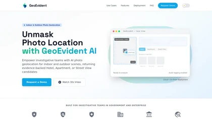
Geoevident is an AI geolocation intelligence platform that performs forensic photo and video geolocation for indoor and outdoor scenes, returning ranked location candidates with visual matches and mapped coordinates plus exportable case reports and audit logs.
Subscription
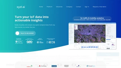
xyzt.ai provides a single‑interface analytics platform that visualizes and analyzes spatio‑temporal traffic, mobility, maritime, and IoT data. It supports raw GPS, map‑matched paths, and aggregated volumes without coding, safeguards data privacy, and offers GenAI queries.
Free

arivis.cloud is a cloud-based AI platform for automated, high-throughput microscopy image analysis. It enables life science researchers to build no-code ML workflows for scalable, reproducible segmentation and processing.
Freemium
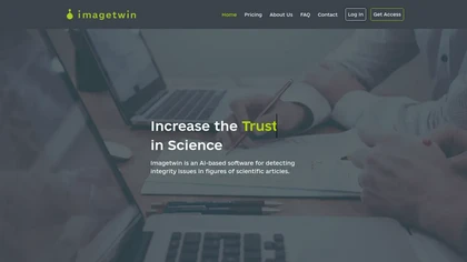
ImageTwin is an AI tool for detecting image integrity issues in life science manuscripts, identifying manipulation and duplication in figures, and enhancing peer-review processes by scanning against a database of 75 million images for potential plagiarism.
Subscription
- $2.5
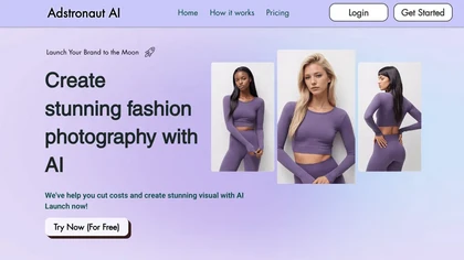
Adstronaut AI automates fashion design and pre‑production. From moodboards, it generates up to 256 production‑ready visuals, fabric simulations, mockups, sizing charts, and SEO‑rich product data, enabling rapid collection launches and efficient factory handover.
Freemium
- $23.99

Spatia is an AI-powered tool for sales and design businesses. It streamlines design creation, rendering, and presentation in browsers, featuring landscape, kitchen, and architecture options, along with continuous customer support for enhanced design efficiency and client communication.
Freemium

AtlasNavi is an AI navigation app that uses a smartphone camera to analyze road conditions at 25 Hz for more accurate routing. It records trips, offers live streaming, group tracking, walkie‑talk, rewards via 3‑D vehicle NFTs, and maintenance alerts.
Freemium

LatenceTech offers a cloud or on‑prem platform that applies machine learning for real‑time monitoring and predictive analytics across Wi‑Fi, LTE, 5G, and satellite networks, delivering latency, throughput, and packet‑loss alerts to keep telecom, utilities, and logistics networks reliable.
Freemium

VISuite AI is a scenario‑based video analytics platform that delivers real‑time behavior and facial recognition, automated intrusion detection, and forensic search across surveillance feeds. It processes geo‑tagged events, reduces false positives, and streamlines security monitoring.
Freemium
Zipsmart offers AI‑driven real‑estate analytics across all U.S. states, blending Mapbox and OpenStreetMap data for precise geographic context. It delivers market forecasts, buy/sell signals, price trends, and customizable indicators to guide sellers, buyers, investors, and agents.
Freemium
Solar Explorer simulates the Solar System with accurate orbital and rotational physics, offering 3‑D views, surface textures, time‑evolution modes, and mission replays of Pioneer, Voyager, and New Horizons for educational and research use.
Freemium
Spatialzr delivers real‑time market analysis for commercial real estate across Europe, offering algorithms for site selection and portfolio decision support. It aggregates data on 200 million buildings with 167 metrics, including ESG, to guide investment and allocation.
Freemium
Spatial Media Toolkit converts standard photos and videos into immersive, three-dimensional experiences using AI. It allows users to enhance their visual memories, manage entire photo libraries, and save transformed media for interactive sharing and viewing.
Free
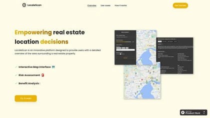
LocaleScan maps schools, hospitals, and key sites with customizable markers. Users set a location and radius to receive real‑time risk data, environmental and economic indicators, and nearby amenities, enabling informed property and investment decisions.
Freemium
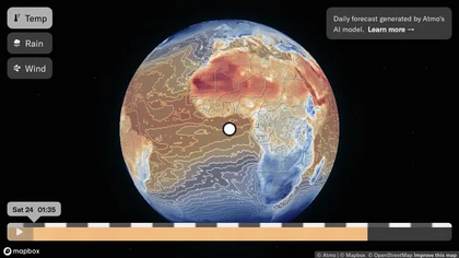
Atmo is an AI-powered weather forecasting tool that generates daily temperature, rain, and wind forecasts up to two weeks in advance.
Free

Airadar AI Toolbox offers a versatile range of AI tools across multiple categories like text, image, and video editing. With features for prompt generation, text enhancement, and more, it's a convenient hub for various AI tasks.
Freemium
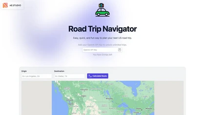
Road Trip Navigator lets users set origin and destination, view detailed Google‑ and INEGI‑based maps with zoom, directional controls, metric/imperial units, satellite and terrain layers, and generate unlimited AI‑enhanced itineraries via an OpenAI key.
Freemium
Contentmaps AI creates topical clusters and authority maps by combining domain analysis, keyword clustering, SERP modeling, and Reddit sentiment. It spotlights content gaps, produces structured briefs, visualizes link opportunities, and streamlines research for teams.
Subscription
- $39/mo

Stockimagery.ai is an AI tool that specializes in enhancing images with features like social media graphic creation, face swaps, and image upscaling. It efficiently generates stock art, wallpapers, animates text/videos for personal or professional use.
Subscription
- $29/mo

Ask Maps Immersive Navigation uses conversational AI within Google Maps to answer complex, location-based queries, generate personalized trip itineraries and stop suggestions, show 3D visuals and street previews, and provide real-time traffic-aware turn-by-turn and parking guidance.
Free