What is LocaleScan?
LocaleScan
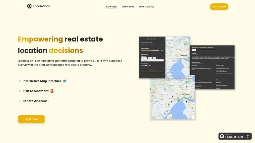
Provides an interactive map that displays custom markers for schools, hospitals, and other key sites, allowing users to zoom and explore neighborhood layers.
Offers real‑time risk data, including crime statistics, environmental hazards such as noise and pollution, and economic indicators like unemployment and growth rates.
Highlights benefit information such as nearby restaurants, shopping, gyms, and educational facilities, enabling quick assessment of lifestyle and convenience.
Supports home buyers, renters, investors, real‑estate agents, and urban planners by delivering data‑driven insights into property suitability and investment potential.
The workflow is simple, input a location, set a scan radius, and receive a comprehensive area report.
All features are aimed at helping stakeholders evaluate neighborhood safety, amenities, and long‑term value for informed real‑estate decisions..
LocaleScan user reviews
Would you recommend LocaleScan?
LocaleScan's key features
-
Interactive map with zoom layers
-
Customizable icon markers
-
Crime rate risk assessment
-
Environmental hazard details
-
Economic stability evaluation
-
Local amenity listings
LocaleScan use cases
-
Generate a neighborhood risk assessment report for prospective homebuyers, integrating real‑time crime data, environmental hazards, and proximity to schools and hospitals using LocaleScan's interactive safety map.
-
Assist real‑estate investment firms in evaluating property portfolios by visualizing economic indicators and amenities proximity within a specified radius, enabling data‑driven acquisition decisions.
-
Support city planners in zoning and development by overlaying environmental hazard data, crime statistics, and key site markers to identify optimal locations for new public facilities.
Who is it for?
-
Real estate analysts
-
Property investors
-
Market researchers
-
Business strategists
-
Location scouts