Residential Traffic Routing
The best 27 Residential Traffic Routing AI tools - Free & Paid
Explore 27 AI for Residential Traffic Routing

Routerra optimizes delivery and fleet routes with AI-assisted bulk stop import, traffic-aware routing, stop constraints (time windows, priorities), vehicle and route restrictions, manual adjustments, large-stop handling, exportable plans and direct navigation for drivers and dispatch.
Free trial
OpenRouter gives one API key to access 300+ models from 60+ providers, SDK‑compatible, with visual routing, automated fall‑back, edge hosting, data‑policy controls, and agentic tools for building efficient autonomous workflows.
Freemium

Thordata Residential Proxy is a web scraping service with 60M+ residential IPs across 195 countries, ensuring high-speed, low-latency data collection. It offers AI training, social media management, and real-time traffic monitoring via an intuitive dashboard.
Free trial
Bambi uses AI to optimize real‑time dispatch of non‑emergency medical transportation, matching drivers and vehicles efficiently. Dispatchers see live dashboards, drivers receive mobile trip details, routes are tracked, safety alerts are issued, and detailed analytics inform fleet decisions.
Subscription
- $69/mo

Dynaroute is a cloud-based route optimization and dynamic routing platform for fleet and last-mile delivery, using AI to plan constrained routes (capacity, time windows, skills, hazardous loads), with real-time traffic, live tracking, mobile dispatch, and API integrations.
Subscription
- $29/mo
ProxyCC is a large-scale residential proxy network providing over 90 million IPs across 190+ locations. It offers rotating, static, and ISP proxies with granular geo-targeting and API tools for scalable web scraping and data collection.
Free trial
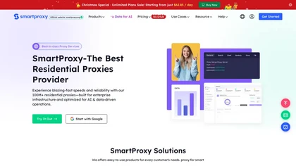
SmartProxy is a global proxy network offering 100M+ residential IPs with advanced geo-targeting and session control. It provides developer tools and a management dashboard for web scraping, ad verification, and other data-intensive tasks.
Freemium
SmoothRide is an AI platform that aids municipal planners and civil engineers in designing safer bike infrastructure, offering data‑driven recommendations for curb extensions, permeable pavement, barriers, and shelters. It aggregates community feedback to prioritize projects and improve cyclist safe
Freemium

iris roads automates road inspections with AI cameras, automatically redacts privacy, identifies defects such as potholes and cracks, delivers condition indices and repair priorities to public‑works dashboards, and integrates with CityWorks and Cartegraph for streamlined workflow and cost savings.
Freemium
Homeway offers secure, low‑latency remote access to Home Assistant servers with end‑to‑end encrypted WebRTC video. It integrates Google Home/Alexa, delivers conversational AI via Sage, and provides local‑only access to services like Node‑RED, AdGuard, Bitwarden, and Pi‑hole.
Freemium
- $3.49/mo
WalkRideGo plans routes for walkers, cyclists, tour groups, and businesses. Create maps, add stops, and view detailed navigation data. Track progress in real time, record metrics, export routes, and integrate into logistics workflows across multiple transport modes.
Free trial
- $30

AtlasNavi is an AI navigation app that uses a smartphone camera to analyze road conditions at 25 Hz for more accurate routing. It records trips, offers live streaming, group tracking, walkie‑talk, rewards via 3‑D vehicle NFTs, and maintenance alerts.
Freemium
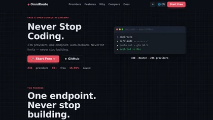
OmniRoute is an open-source AI gateway that routes requests to 236 LLM providers via a single /v1 endpoint, offering multi-provider routing with auto-fallback, token compression, persistent memory, resilience controls, MCP/A2A support, and self-hosted analytics.
Freemium

Roam Around is an AI travel planner that customizes itineraries based on user constraints such as budget, duration, pet‑friendly or family‑friendly needs. It generates day‑by‑day schedules with attractions, transport, accommodation, and real‑time updates for multi‑city trips.
Paid

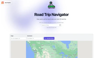
Road Trip Navigator lets users set origin and destination, view detailed Google‑ and INEGI‑based maps with zoom, directional controls, metric/imperial units, satellite and terrain layers, and generate unlimited AI‑enhanced itineraries via an OpenAI key.
Freemium

Currux Vision processes CCTV video for real‑time monitoring, enforcement, and safety. It automates object detection, classification, and tracking, and can autonomously control PTZ cameras. Supports edge, hybrid, and cloud deployments with NVIDIA GPU servers, delivering actionable metadata to operato
Freemium
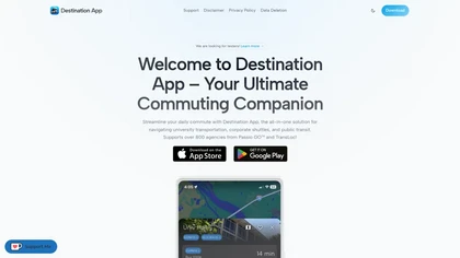
Destination App provides real‑time bus tracking and ETA updates for over 1,000 global transit systems. Users view live positions, stop‑by‑stop arrivals, and dwell times; search routes, use presets, or go offline, all without an account.
Freemium
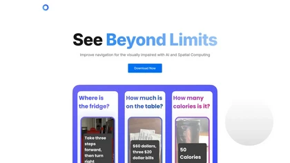
PingPath is an AI powered app that enhances indoor navigation for those with visual impairments, using spatial audio, LIDAR, and interactive maps to identify obstacles and provide real-time information about surroundings through voice-activated inquiries.
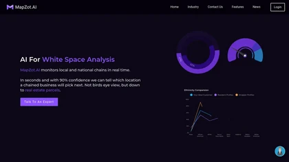
MapZot.AI provides location intelligence for site selection, revenue forecasting, and impact analysis. It integrates live traffic, GIS, and mobile data to model foot traffic and competition, generating 360° property reports with projections, benchmarks, and business activity.
Freemium
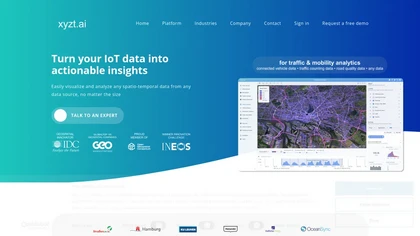
xyzt.ai provides a single‑interface analytics platform that visualizes and analyzes spatio‑temporal traffic, mobility, maritime, and IoT data. It supports raw GPS, map‑matched paths, and aggregated volumes without coding, safeguards data privacy, and offers GenAI queries.
Free
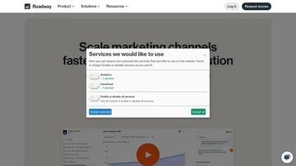
Roadway aggregates performance‑marketing data from multiple sources into a single warehouse‑native workspace, enabling cross‑channel attribution, KPI dashboards, and AI‑driven weekly insights. Users can monitor campaigns, visualize CAC, payback, churn, and execute recommendations directly.
Subscription
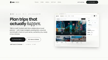
Trek is a self-hosted, open-source travel planner enabling real-time collaboration on itineraries, budgets, and trip logistics. It combines drag-and-drop itinerary editing, route optimization, multi-currency budgeting, and live group coordination via websocket sync and chat.
Free

Ask Maps Immersive Navigation uses conversational AI within Google Maps to answer complex, location-based queries, generate personalized trip itineraries and stop suggestions, show 3D visuals and street previews, and provide real-time traffic-aware turn-by-turn and parking guidance.
Free
This AI platform aggregates data on urban density, proptech, climate resilience, demographics, and transportation tech to model development scenarios. It delivers actionable insights for developers, investors, and planners to align projects with sustainability, economic diversification, and communit
Freemium
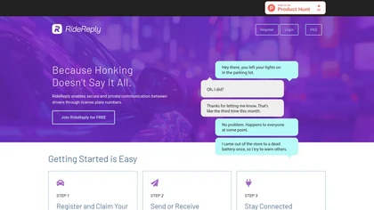
Ridereply enables secure communication between drivers using their license plate numbers while ensuring privacy. The platform includes encrypted messaging and AI monitoring, enhancing user safety and engagement through instant email notifications.
Free