Citizen Science Plant Identifier
The best 14 Citizen Science Plant Identifier AI tools - Free & Paid
Explore 14 AI for Citizen Science Plant Identifier
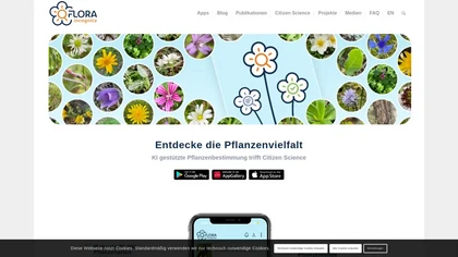
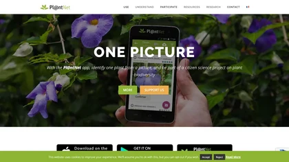
Flora Incognita is a free AI plant‑ID app matching 30,000+ species. Capture photos, receive accurate (98.8%) matches, view detailed fact sheets, use offline mode for fieldwork or schools, and upload observations to a citizen‑science project.
Freemium
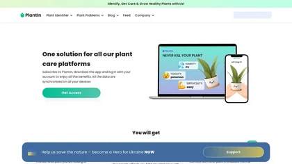
PlantIn identifies plants, flowers, and fungi from photos, matching them to a 17,000‑species database. It provides disease detection, care steps, maintenance schedules, expert support, community sharing, and cross‑device sync for hobbyists and professionals.
Subscription
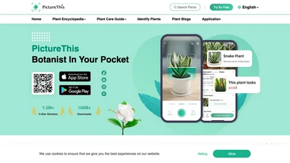
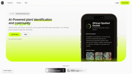
PictureThis uses AI photo recognition to instantly identify plants, trees, and insects, offering species names, disease detection, care tips, toxicity alerts, and seasonal guidance. It supports offline access, a vast multilingual encyclopedia, and community sharing.
Free trial
PlantIdentification AI Tool: Offline/embedded image recognition app for identifying plants from a database of 10,000+ species. Supports citizen science initiatives, facilitating fast plant identification for enthusiasts and researchers.
Free

Kepl is a mobile app that utilizes advanced image recognition to identify various objects, including plants, insects, and products. It allows real-time scanning and analysis, providing detailed information and enabling users to save their discoveries for future reference.
Freemium

Neighborbrite lets users upload a yard photo to generate instant, customized garden layouts with selectable styles and features. It offers climate‑appropriate plant suggestions and a global design gallery, all via a simple, install‑free web interface.
Free

Weedtalk.io is a web-based tool for weed identification and management. Users can upload images for analysis and receive detailed reports on specific weeds, including management tips and history tracking, suitable for both DIY enthusiasts and professionals.
Free trial

SeeTree digitizes large farms with AI, scanning millions of trees via drones, aircraft, and satellites to provide per‑tree metrics, pest‑management, yield forecasting, GIS mapping, and asset tracking, boosting yield, cutting inputs, and improving operations.
Freemium

Picterra delivers GeoAI analytics converting satellite and aerial imagery into near-real-time land monitoring and geospatial insights, detecting land-use change, deforestation, erosion, and compliance risks, linking outputs with ESG and supply-chain data for prioritized interventions and reporting.
Freemium
Frondly is an AI-powered plant identification tool that uses image recognition to quickly identify plants and provide care instructions. It features a community for plant enthusiasts and a chatbot for real-time interaction with a botanical expert.
Free trial

Cybertiks uses satellite imagery and AI to provide accurate soil nutrient, texture, and mineral data for agricultural fields. Users enter coordinates to view up‑to‑date weekly metrics on dashboards, integrating optical and radar sensor fusion.
Freemium
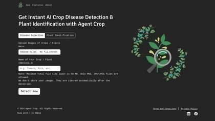
Agent Crop is a mobile app that instantly detects crop diseases and identifies plant species from PNG, JPG, or JPEG images up to 50 MB. It processes data on‑device, discards images after use, and supports farmers and horticulturists with quick diagnostics.
Freemium
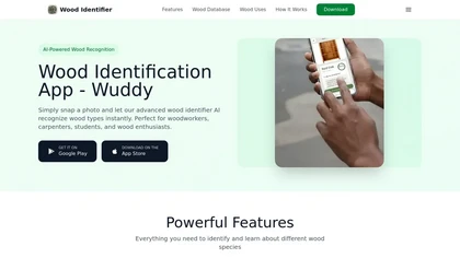
Wood Identifier is an image-based AI app that recognizes wood species from photos, analyzes grain and surface features, provides instant species suggestions with descriptions, common uses and material properties, and lets users save, share and export reference entries.
Freemium