What is CartoVoxel?
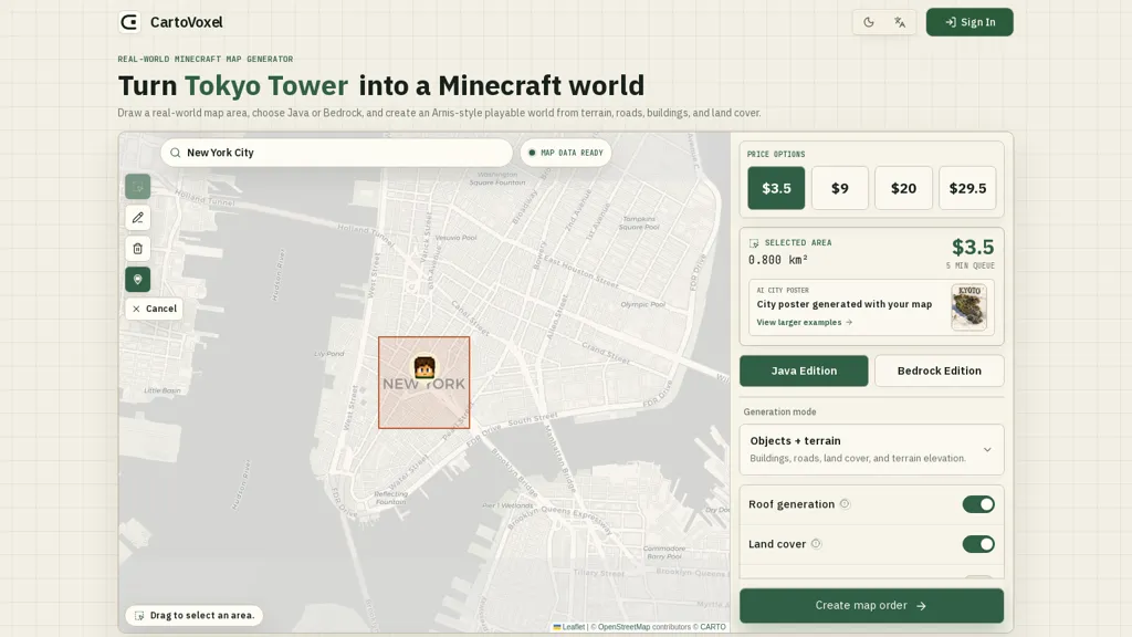
Cartovoxel is a web-based real-world Minecraft map generator that converts selected geographic areas into playable Java (.zip) or Bedrock (.mcworld) worlds.Select exact areas on an OpenStreetMap/Leaflet interface and generate terrain, elevation, roads, buildings, land cover and roof geometry.
Cloud rendering handles heavy processing in-browser so creators can generate maps without installing desktop software or taxing local hardware.Outputs include ready-to-play world files and optional high-resolution city poster visuals for thumbnails or sharing.
Workflow supports presets, generation modes for objects and interiors, and downloadable world files delivered via email link.Suitable for map creators, server admins, educators and mobile users needing accurate voxelization, cross-platform compatibility and fast cloud-based rendering.
CartoVoxel pricing Freemium
Verify on the official pricing page.
View plansCartoVoxel user reviews
Based on 1 review, 100.0% of users recommend CartoVoxel, rated highly for quality results.
Liked for
Would you recommend CartoVoxel?
CartoVoxel's key features
-
Converts selected geographic areas into playable Java (.zip) and Bedrock (.mcworld) Minecraft worlds
-
Area selection via OpenStreetMap/Leaflet interface
-
Generates terrain, elevation, roads, buildings, land cover, and roof geometry
-
Cloud-based rendering for heavy in-browser processing without desktop installation
-
Workflow with presets and generation modes for objects and interiors; downloadable world files delivered via email link
CartoVoxel use cases
-
Create immersive, real-world Minecraft adventure maps by converting selected OpenStreetMap areas into playable Java or Bedrock worlds with cloud-rendered terrain, elevation, roads and buildings—no coding or mods required—then distribute downloadable .zip/.mcworld files to players or students
-
Produce accurate urban visualizations for planners, architects or educators by voxelizing city blocks (preserving building footprints, roofs and terrain elevation) for rapid prototyping inside Minecraft, plus generate high-resolution city posters for presentations and stakeholder feedback
-
Develop location-based learning experiences, tourism guides or marketing assets by extracting neighborhoods from OpenStreetMap into interactive Minecraft worlds with roads and landmarks, paired with printable high-resolution posters and easy-to-share world downloads
Who is it for?
-
Map creators
-
World builders
-
Game developers
-
Urban planners
-
Content creators