What is Arnis?
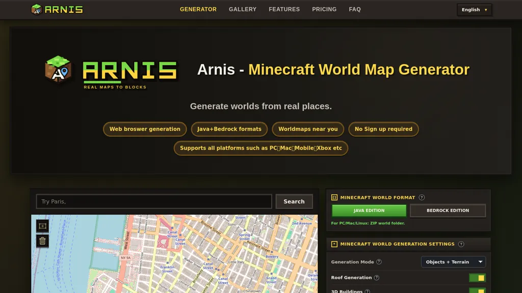
Arnis is a Minecraft world map generator converts real-world map data into playable Minecraft worlds.It uses OpenStreetMap and elevation datasets to recreate roads, buildings, rivers, land use and terrain.
Exports Java edition as a zip world folder and Bedrock edition as a.mcworld file for desktop, mobile and console platforms.Browser-based workflow.search or draw a map area, choose settings (terrain, buildings, roofs, interiors, land cover), then generate and download.
Supports simple roofs, optional interiors and 3D building geometry when source data is available; spawn point and area selection options are included.Suitable for small areas such as neighborhoods, campuses and city blocks; runtime varies with area size and map detail.
Conversion follows source map coverage, so missing or sparse OpenStreetMap data produces correspondingly incomplete in-game features.
Arnis pricing Paid
Verify on the official pricing page.
View plansArnis user reviews
Based on 2 reviews, 0.0% of users recommend Arnis.
Disliked for
Would you recommend Arnis?
Arnis's key features
-
Converts real-world map data into playable Minecraft worlds
-
Uses OpenStreetMap and elevation datasets to recreate roads, buildings, rivers, land use and terrain
-
Exports Java edition as a zip world folder and Bedrock edition as a .mcworld file for desktop, mobile and console
-
Browser-based workflow: search or draw a map area, choose generation settings (terrain, buildings, roofs, interiors, land cover), then generate and download
-
Supports simple roofs, optional interiors, 3D building geometry when source data is available, plus spawn point and area selection options
Arnis use cases
-
Recreate a real-world neighborhood in Minecraft without GIS or coding: select or draw an area from OpenStreetMap with elevation, configure terrain, buildings, roofs and interiors in the browser, then export Java or Bedrock worlds for educational tours or multiplayer roleplay
-
Build accurate training and planning environments for urban designers or emergency responders by importing OSM and elevation data, fine-tuning building footprints, heights and interiors, and exporting small-scale playable worlds for scenario testing and stakeholder walkthroughs
-
Generate location-based exhibits and classroom experiences: draw landmarks or neighborhoods, preserve terrain elevation and building details, customize interiors and roofs, and deliver easy-to-run Java/Bedrock worlds for guided lessons, history recreations, or museum installations
Who is it for?
-
Minecraft builders
-
Urban architects
-
World developers
-
Gis enthusiasts
-
Collaborative builders